Saturday, July 11, 2009

July 11th, 2009 (Day 4) - Monarch Lake

Saturday, July 11th, 2009 (Day 4): Monarch Lake

Now that everyone was here in Colorado, we decided to take an introductory hike together. One of the local hikes suggested was an easy loop around Monarch Lake. If we wanted to add to this hike, we could branch on to the Cascade Creek trail that would be steeper as it followed a beautiful creek up to Cascade Falls.
Trailhead Location: From Granby take U.S. Highway 34 to County Road 6 (Forest Service Road, FSR 125 or Arapaho Bay Road). Follow this road for 10 miles to the Monarch Lake parking area.


County Road 6 followed the shoreline of Granby Lake....


Monarch Lake – an Old Logging Outpost Near Grand Lake
In the early 1900s, Monarch Lake, near Grand Lake, Colorado, was built to store logs before they were transported to a nearby sawmill via flumes and rivers.Today, at 150 acres, it’s dwarfed by nearby Lake Granby (7,256 acres), but it’s kept at a constant level so that visitors can enjoy non-motorized activities.

“The Great Lakes of Colorado”
Monarch Lake is one of six major lakes located just outside of Rocky Mountain National Park. The other bodies of water that form the “Great Lakes of Colorado” are: Grand Lake, Lake Granby, Shadow Mountain Lake, Willow Creek Reservoir and Meadow Creek Reservoir.
The Monarch Lake Trail is 4.0 miles long (round trip), is rated as Easiest and is very heavily used from June through October (open year round).
Elevations:
Trailhead: 8,300'
Highest Point: 8,400'
USGS Maps: Monarch Lake Quad

With the jagged peaks of the Indian Peaks Wilderness as back drop to the lake, this easy loop trail is a popular destination year round. The trail begins at an old cabin that is staffed in the summertime. Inside the cabin are historical photos of the area and trail information. Along the way you will pass an old steam donkey engine, log chute pilings and cabin remains from when this area was logged in 1902


On a beautiful sunny day, we started on our way around Monarch lake. The trail was flat, well-maintained, and the scenery was spectacular...


Check out the video. Jim has spotted some trout in the stream....


About half way around the lake, we reached the split for the Cascade Creek Trail.


Everyone was feeling great, so we decided to head towards Cascade Creek Falls, and just turn around when we started to tire.

Cascade Creek Trail
Description:The Cascade Creek Trail begins at the Monarch Lake Trailhead at an elevation of 8,340 feet and travels along the north side of the lake to the Arapaho - Cascade junction. Here the trail is level and offers great views of the lake. The trail turns east and starts up a narrow valley after entering the wilderness. Soon you come to an intersection where the Cascade Creek Trail continues up the valley and the Southside Trail takes you back around the other side of the lake. The Cascade Creek Trail makes a gentle climb to the northeast to a bridge across the stream that drains Hell Canyon. Soon you hear the rushing sounds of Buchanan Creek. You get a good view of the creek just before climbing the north side of the drainage, making several switchbacks along the way. The junction with the Buchanan Pass Trail is reached in another mile. You will travel through a large park like area of lodgepole pine as you approach the junction. At the junction the trail travels east and then turns southeast (right) towards Pawnee Pass. Cascade Falls is about 1.5 miles from the junction. These falls are very beautiful and can be easily seen from the trail. Horses are not permitted beyond the falls. The trail follows the north side of Cascade Creek for another 1.4 miles to the junction with the Crater Lake trail and the Pawnee Pass trail. The Cascade Creek Trail climbs 1,700 feet to an elevation of 10,040 feet. This trail receives heavy day and overnight use and is of moderate difficulty.Features:
Length: 6.4 miles (10.2 kilometers)
Elevation Range: 8,340' - 10,040'
Elevation change: 1,700 feet
Difficulty: Moderate


Cascade Creek..............


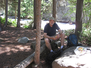
For lunch, we had sandwiches from the Safeway in Fraser. We found an open spot near Cascade Creek, a beautiful campsite, and stopped to eat and relax.


After lunch, we continued up the trail in the direction of the falls. When we reached a bridge, we decided we had gone far enough and decided to turn around. We climbed out onto some rocks where there was a nice vantage spot and rested for a few minutes.


The brown trees are the result of the damage of the Pine Bark beetle, which has killed a lot of the pine trees in this section of Colorado.
We returned to the junction with the Monarch Lake trail and took a break. We met a young lady, Mariah, and her parents, while we rested.


The trail around the rest of Monarch Lake had a nice bridge that crossed the creek.......


We had views of the beautiful water.....


And beautiful flowers........


Another log bridge to cross (fun!!)..........................


This is the old steam donkey engine mentioned earlier......


Finally, the last part of the trail around the lake, and we were finished.


Everyone did great. It was a good warmup hike for all of us. Now we are looking forward to the rest of the week ahead. Tomorrow is Sunday, and we are planning to take a 1/2 day raft trip on the Colorado River. Should be a blast..


Friday, July 10, 2009

July 10th, 2009 (Day 3)

Friday, July 10th, 2009:

Today is the day when the rest of our group arrives in Colorado. Cindy and I must check out of our accommodations at Silver Creek, after trying unsuccessfully to change our reservations from Fraser.

We speak with Jim and Ruth after they land in Denver and make arrangements to meet them at the top of Berthoud Pass around 2pm. As we had some time to kill, we headed up to Winter Park, had a nice lunch at Rudi's Deli, and walked around some of the shops

Cindy and I arrive at the Pass around 1:30, take a short hike on the Continental Divide Trail, and meet Jim, Ruth, Dave and Nitsa around 2:30.


The weather is beautiful, warm (80), a little windy at the Pass. We drive down to Winter Park and have ice cream at "The Scoops" while we wait until 4 pm to check into our condos in Fraser.


The drive from Berthoud Pass through Winter Park to Fraser passes through a valley that is dominated by Byers Peak on the West......


We arrive in Fraser, CO, "Icebox of the Nation".....


The visitor center in Fraser has a little park with statues of the some famous mountain men.. such as Jeremiah Johnson....


Except for Pete and Barb, we are now settled in our 2 condos at Twin Rivers. Pete and Barb flew to Denver today and will join us tomorrow morning.
6 of us pile into the Edge............

and drive to Winter Park to eat at Randi's Irish Pub

Thursday, July 9, 2009

July 9th, 2009 (Day 2) Columbine Lake

Thursday, July 9, 2009 (Day 2):

Our plan for Day 2 in Colorado was to find a nice hike to stretch our legs but not put us into distress. We wanted to find out if we were in shape to try to climb a couple of 14'ers later in the trip. We visited the Welcome Center in Fraser and got a couple of maps and a list of local hikes. We decided to try a hike to Columbine Lake, located in the Indian Peaks Wilderness area. The hike is about 5.8 miles roundtrip. The trailhead is at 10,000 ft and the Lake is at 11,000 ft.

Trailhead Location: Head north on U.S. Highway 40 from Fraser and turn right (east) onto County Road 83. When the road forks go left onto County Road 84. Follow this road for 10.5 miles, then turn left on the road to the Junco Lake Trailhead.


Here is a description of the hike found on the internet:

"This is a very popular day hike. It follows an old jeep trail until it reaches the junction with the Caribou Pass Trail at 1.7 miles. As the Caribou Pass Trail splits away, the Columbine Lake Trail continues along the creek to its source at Columbine Lake. This tree-lined lake is nestled in a steep basin on the northwest face of Mount Neva. Campfires are prohibited at Columbine Lake to protect the delicate nature of the alpine tundra.

This trail is in the Arapaho National Recreation Area (ANRA) which requires a day-use fee ($5.00) or display of your golden passport on the dashboard of your vehicle. If you are camping overnight in the wilderness, then only a wilderness permit is required. Just leave the parking stub from the wilderness permit on the dashboard of your vehicle in the parking lot.

Columbine Lake is a beautiful emerald green lake situated below Mount Neva. It is a shallow lake containing rainbow and cutthroat trout. Most of the shore is easily accessible for fishing.

The Columbine Lake trail begins on the Caribou Pass trail and travels 1.3 miles to Columbine Lake. The trail travels along a large meadow and soon enters a spruce forest. It makes a moderate climb through the forest, paralleling a stream. Leveling off, the trail continues up through some meadows to a point where a stream comes down off the hill. Here it begins a climb up through a rocky gap toward Columbine Lake. It continues to wind its way up through the forest along the edge of some meadows. The climb becomes more moderate as it progresses up through the gap. Eventually it levels off and makes its way through some wet meadows to the lake. The elevation gain is about 500 feet. There are some level spots in the meadows around the lake but some may be too wet to camp. You can pretty much access the entire shoreline of the lake for fishing. This trail sees moderate day use and low overnight use. The level of difficulty for this trail is moderate.

Columbine Lake Trail (Wildflowers)
Columbine Lake is nature’s vast and overwhelming spectacle where one flowering plant covers acres upon acres. Depending upon the season, you’ll see miles of white marsh marigold (Caltha leptosepala) or columbine (Aquilegia caerulea).
The hike to Columbine Lake is a moderate 2.4 miles one way and 960 feet gain in elevation. Still, half the difficulty is getting there by car. The 11.4 mile dirt road is pocked with potholes alternating with high bumps that many cars won’t traverse. And it feels like it goes on forever. But once there, such vast spaces provide a solitary hike in spectacular scenery.
This sub-alpine scenario consists of meadows at tree line. When the snows melt, they leave a saturated soil. White marsh marigolds grow in water as well as soil, their tenacious roots determined to survive in frigid conditions. Wide, succulent leaves soak up moisture and appear to float like alpine water lilies.
You’ll find exquisite natural gardens of seeping water, mosses, ferns and wildflowers. They have only a month or two to flourish and grow. The rivulets of water, gentle and consistent, provide a tiny climate of perfection to satisfy their needs.
The Columbine Lake Trail opens into wide vistas, where you can see miles and miles of mountains. A vast sky, huge as the ocean, collects clouds. Weather patterns a state away are clearly visible.
If you’re intrepid, hike all the way to the lake, but bear in mind that snow may blanket Columbine. A few hikers on the trail groaned when they bedded down in several feet of snow, not guessing that snow would persist into the height of summer. But at high altitude and a late day drenching of rain elsewhere quickly turns to snow here.
Precautions
Take water, food and sunscreen. Take warm clothing, too. At Columbine Lake, you could be alone for quite a while before another hiker would find you.

Columbine Lake is located near Fraser and Tabernash. From US 40, turn onto County Road 83, then onto Meadow Creek Road. Follow the signs to Junco Lake because you’ll not see a single sign for Columbine Lake. But the Junco Lake parking lot is where you’ll start for Columbine Lake.

The dirt road to the trailhead parking lot is long – 11.4 miles – and the last half is filled with deep ruts.
Recommended books for identifying mountain wildflowers:
"Guide to Colorado Wildflowers" G.K. Guennel, Westcliffe Publishing, 1995
"Rocky Mountain Wildflowers" Jerry Pavia, Fulcrum Publishers, 2004"

Sounds pretty good, doesn't it? Well, it was a beautiful hike. The dirt road in was long, 10-1/2 miles, but was in good shape. We didn't have any problems. We passed Meadow Creek Reservoir on the way in to the Junco Lake Trailhead.

The start of the trail is beautiful, as we walk through pines and open meadows.


Here I am pointing in the direction of Columbine Lake. It is nestled below those peaks ahead:


There were wildflowers all along the hike............


Most of the trail was in good shape, but we also had to pass through some wet spots, using logs in many places as bridges.


We followed a beautiful stream in many places


Finally, we reached the lake


Check out the video:


The hike was a good warmup for us. We had a couple of spots where it was steep, but only for short distances. We could feel the altitude, but we didn't have headaches, we just felt winded.

Back at Silver Creek Resort, we enjoyed a beautiful sunset to end our second day in Colorado.

Wednesday, July 8, 2009

July 8th, 2009 (Day 1):

Cindy and I flew from Newark to Denver and arrived around noon (84 degrees and sunny) We had to take a shuttle bus (Super Shuttle) to Lakewood to pick up our car from Budget. Renting from a site away from the airport saved us from paying the high Airport tax. The shuttle took about 45 minutes.

We had reserved a 4WD Jeep Cherokee (or equal). Naturally, there were none left, so we were offered a Ford Edge AWD. It seats 5 and has high clearance, so we think we are good for the trip.

We were getting pretty hungry about now, so we asked Mac at Budget if he knew a good place to get a sandwich. He recommended a new place down the street (8809 W. Colfax Avenue, Lakewood) that was called the Beehive, or something like that. They had sandwiches made with Honey bread. Sounded fine so we drove off to get lunch. It was on our way to Rt 70 anyway.


We had a great experience at this little sandwich spot. The owner, Rick Witzke, was very friendly and excited about his new place. The food was very good. Along with the sandwiches they served tasty little 'chips' made from the honey bread. The trip was starting well.

After lunch we drove west on Rt 70 to Rt 40 North towards Empire, Winter Park and Fraser. Rt 40 crosses through Berthoud Pass, elevation 11,307 feet, located on the Continental Divide.

We stopped at the Pass to stretch our legs. The Continental Divide Trail runs through the Pass. We took a short walk but did not want to over-exert ourselves the first day, so we didn't go far. We could feel the effects of the altitude already.


The view from the Pass looking north was beautiful..


The mountains you see here are known as the Indian Peaks. In the far distance you can see Longs Peak in Rocky Mountain National Park.


We spent a little time scouting out Twin Rivers Condos where we will be staying later in the week when the rest of the group arrives. It took us a while to find the management company and then actually find the condos. The management company, Alderwood Management, is now located in the 2nd floor of an office building above the Optical Center (in the Safeway shopping area). They re-arranged our accommodations so that we are both in the same building, Byers (units #4 & #6). Finally we headed up to Silver Creek Resort in Granby where we are staying tonight.

Dinner that night was in Granby at the Brickhouse 40, where we ate outside. It was a beautiful end to our first day in Colorado.


Monday, July 6, 2009

Explorer's Prayer

Francis Drake was England's most famous sailor and explorer, he sailed around the world in 'The Golden Hind' in 1580 and led the outnumbered British Navy to defeat the Spanish Armada in 1588. This prayer was found in his ship's diary, written on the eve of one of his great adventures:

Disturb us, Lord, when we are too well pleased with ourselves,
When our dreams have come true
Because we dreamed too little,
Because we sailed too close to the shore.

Disturb us, Lord, when
With the abundance of things we possess
We have lost our thirst
For the waters of life;
Having fallen in love with life,
We have ceased to dream of eternity
And in our efforts to build a new earth,
We have allowed our vision
Of the new Heaven to dim.

Disturb us, Lord, to dare more boldly,
To venture on wilder seas
Where storm will show Your mastery;
Where losing sight of land,
We shall find the stars.

We ask You to push back
The horizons of our hopes;
And to push us in the future
In strength, courage, hope, and love.
This we ask in the name of our Captain, who is Jesus Christ.

Amen

Sunday, July 5, 2009

Accommodations

Our reservations have been made at:

Twin Rivers Condominiums
330 Sterling Way Road
Fraser, Colorado 80442

Summer Activities:

Summer Activities Available Through The Activity Desk

Discounted Hot Sulphur Springs Tickets: $14.50
Rodeo: (Saturdays in July & August): $10 adult / $6 child

Other things to do:

Golfing: Pole Creek and SolVista, 800-551-9943 / 726-5701 for tee times & prices
Winter Park Resort Tickets: http://www.skiwinterpark.com/
Horseback Riding: http://www.grand-county.com/Horseback_Riding.aspx
Rafting: http://www.madadventures.com
Georgetown Loop: http://www.georgetownlooprr.com
Wildlife Tours: (child rate is 11yrs & under) Rocky Mountain National Park $40 adult, $20 child Moose tour / Willow Creek Pass $40 adult, $20 child
Historical Tours: Gold Mines and Ghost town! $40 adult, $20 child
Blackhawk/Central City Transportation: $45 per person

Check out the Calendar of Events for special events throughout the winter season.

On Your Own

Grand County has three spectacular museums
*These Museums are open Wed-Sat 11am to 4pm, Sun 1pm to 4pm.

Grand County Museum -
located in Hot Sulphur Springs on Hwy 40. *

The Cozen's Ranch Museum -
located just west of Winter Park on Hwy 40 *

The Fraser Walking History Museum -
located in Fraser on Hwy 40 *

Scenic Drive -
Moffat Road / Corona Pass: drive along the old railroad to the "Top of the World". You'll pass a historic trestle and the abandoned town of Arrow, once a thriving railroad town. This is a self guided auto tour that takes you on top of the Continental Divide, also one of the highest and most torturous railroad routes ever conceived. Pick up a self guided tour booklet at Cozens Ranch Museum or Winter Park Visitors Center. From Winter Park take US Hwy 40 2 miles south and turn left onto the Moffat Road, the "Over the Hill" route.

Boat Rentals -
SolVista Marina 970-627-8158 (Grand Lake), Beacon Landing 970-627-3671 (Lake Granby), Trail Ridge Marina 970-627-3586 (Shadow Mountain Lake)

Cinema -
Silver Screen Cinema (Winter Park) 970-726-5390

Fishing -
Many streams, rivers, lakes and reservoirs.

Winter Park Resort -
Three interconnected mountains offer groomed terrain , steep and deep powder runs and world-class moguls. Fun, Family, Adventure. Skiable Terrain - 2886 acres, Vertical Drop - 3060 feet, Number of Trails - 134, Number of Lifts - 22 (8 high-speed quads), Annual Snowfall - 369 inches.

Rocky Mountain National Park -
National Forest Service

SolVista Golf & Ski Ranch -
A year-round, family-friendly resort with a rustic Colorado ranch theme. All ski trails lead back to one base area making SolVista fun and convenient for families and groups. Skiable Terrain - 287 acres, Vertical Drop - 1000 feet, Number of Trails - 33, Number of Lifts - 4 (8 high-speed quads), Annual Snowfall - 220 inches.

Devil's Thumb Ranch Cross-Country Ski Center -
Nestled at the foot of the Continental Divide in the beautiful Ranch Creek Valley, Devil's Thumb Ranch provides seclusion, spectacular scenery and some of Colorado's finest cross-country skiing. 100 kilometers of groomed trails for classic, skate-skiing and snow shoeing, Dogs allowed on some trails. Rentals, lessons.

Grand Lake Touring Center -
The open, rolling terrain and panoramic views of Rocky Mountain National Park provide the backdrop for your skiing experience at Grand Lake Touring Center. 35 kilometers of groomed trails for classic, skate-skiing and snow shoeing. Dogs allowed on some trails. Rentals, lessons. Call 970-627-8008

Hot Sulphur Springs -
Soak at a beautiful mineral resort, only 25 minutes west on Hwy 40. Open daily 8am-9pm. Massages, facials, and body works available, 725-3306.

Snow Mountain Ranch Nordic Center -
With awe-inspiring views of the Continental Divide and Indian Peaks, Snow Mountain Ranch offers trails and terrain for everyone -- From beginners to world-class athletes. 85 kilometers of groomed trails for classic, skate-skiing and snow shoeing. Dogs allowed on some trails. Rental, lessons, night-skiing.

Gambling -
Blackhawk and Central City are only 70 miles away. Take Hwy 40 to I-70 East towards Denver. Exit Hwy #6, follow signs to Hwy #119, take Hwy #119 to Blackhawk, watch for Central City turn. Transportation available (see Above)
YMCA of the Rockies / Snow Mtn Ranch - 970-887-2152

Souvenir Making -
Pottery Painting 726-4959, Trail Ridge Art Company

Rocky Mountain Repertory Theater

Grand Adventures -
Guided and unguided tours. Located at Beaver Village on US Hwy. 40. Snowmobiling, Horseback Riding, Sled dog Rides, and Sleig

Wednesday, July 1, 2009

Assault Team Complete

Well, our team has been assembled. Wow, what a team we have !

We are looking forward to a great time in Colorado.

To keep in touch, we will be relying on our cell phones. Here is a list of numbers to use (DELETED 1-11-2013)

Uncle Charley:
Cindy Belle:
Matt:
Kitty:
Smith & Smith:
Bense:
Rufus:
Oreo Dave & Tanzanian Mountain Goddess: